Putting 8 Million People on the Map:
Revolutionizing crisis response through open mapping tools
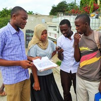
Open source mapping tools are revolutionizing disaster preparedness and response around the world. After the Nepal Earthquake in 2015, more than 7000 contributors came together using open source tools such as the Humanitarian OpenStreetMap Team's Tasking Manager to make more than 13 million edits to OpenStreetMap in the first two weeks after the earthquake. These tools are also empowering communities and international NGOs such as the American Red Cross and Medicins Sans Frontiers to map vulnerable areas before disasters occur. Using the power of the crowd, over 4000 "Missing Maps" volunteers have now put an area where 7.5 million people live onto OpenStreetMap for the first time. These efforts, powered by open source tools, are having real life saving impact and been credited for helping stop the spread of Ebola (http://www.fastcolabs.com/3037350/elasticity/inside-the-crowdsourced-map-project-that-is-helping-contain-the-ebola-epidemic) and improving the Nepal Earthquake response (http://www.wired.co.uk/news/archive/2015-04/28/mapping-nepal-after-the-earthquake)
SUMMARY Open source mapping tools are revolutionizing disaster preparedness and response around the world. After the Nepal Earthquake in 2015, more than 7000 contributors came together using open source tools such as the Humanitarian OpenStreetMap Team's Tasking Manager to make more than 13 million edits to OpenStreetMap in the first two weeks after the earthquake. These tools are also empowering communities and international NGOs such as the American Red Cross and Medicins Sans Frontiers to map vulnerable areas before disasters occur. Using the power of the crowd, over 4000 "Missing Maps" volunteers have now put an area where 7.5 million people live onto OpenStreetMap for the first time. These efforts, powered by open source tools, are having real life saving impact and been credited for helping stop the spread of Ebola (http://www.fastcolabs.com/3037350/elasticity/inside-the-crowdsourced-map-project-that-is-helping-contain-the-ebola-epidemic) and improving the Nepal Earthquake response (http://www.wired.co.uk/news/archive/2015-04/28/mapping-nepal-after-the-earthquake)
TOPICS COVERED This main track presentation will cover these tools and the people and processes that make them successful. Specifically, the presentation will discuss the impact that three open source tools are making:
1) OpenStreetMap Tasking Manager (tasks.hotosm.org) OSM Tasking Manager is a mapping tool designed and built for the Humanitarian OSM Team collaborative mapping. The purpose of the tool is to divide up a mapping job into smaller tasks that can be completed rapidly. It shows which areas need to be mapped and which areas need the mapping validated. This approach facilitates the distribution of tasks to the various mappers in a context of emergency. It also permits to control the progress and the homogeinity of the work done (ie. Elements to cover, specific tags to use, etc.)
2) OpenStreetMap Export Tool (export.hotosm.org) The OSM Export Tool makes it possible for humanitarian response organizations to easily export maps and data from OSM for use on smartphones and GPS devices prior to deploying to the field. The exports have been credited with aiding search and rescue efforts in Haiti after the 2010 earthquake.
3) OpenAerialMap (beta.openaerialmap.org) After a disaster, satellite and drone imagery is critical to helping map affected areas, identify damage, and map displaced persons camps. While much imagery is made available for free, until now there has been no central place for search and access it. OpenAerialMap provides the first completely open imagery platform and network for aerial imagery.
AUDIENCE ENGAGEMENT The presentation will utilize mixed media (audio, visual, short film clips) to demonstrate the power of open source technology for disaster response. In addition to a lecture, short demonstrations of the tools will be given so that audience members can see live disaster mapping in action.
PRESENTERS Tyler Radford, Executive Director, Humanitarian OpenStreetMap Team http://hotosm.org/updates/2015-10-02hotannouncestylerradfordasourexecutivedirector
Drazen Odobasic, System Administrator, Humanitarian OpenStreetMap Team
Speakers
| Blake Girardot |