Tools for linking Wikidata and OpenStreetMap
Software for adding links between open data projects
- Track: Main Track - K Building
- Room: K.1.105 (La Fontaine)
- Day: Saturday
- Start: 18:00
- End: 18:50
- Video only: k1105_la_fontaine
- Chat: Join the conversation!
Wikidata and OpenStreetMap are collaborative open data projects that contain structured data for real world places and things. Adding links between the projects makes the data more useful, but doing this by hand is laborious. I've written a software tool that automates much of the process.
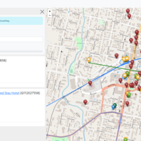
Editors of OpenStreetMap can use my software to search for a place or region, generating a list of candidate matches from Wikidata, which can then be checked and saved to OpenStreetMap.
Linking the two projects isn't without controversy. They use different licenses which raises questions about what information from one project can be copied to the other.
In the presentation I will give details of a new version of the editing tool.
I will talk about the benefits of linking, the process of finding matches, the community response - including the controversy - and how people can get involved.
Speakers
| Edward Betts |